![How Did Romans Build Such Straight Roads [Revealed]](https://giglegravity.site/wp-content/uploads/2026/07/How-Did-Romans-Build-Such-Straight-Roads-Revealed.jpg)
A Vast Transportation Network
Ancient Roman engineers created one of the largest and most advanced road networks of the ancient world. These roads extended across Europe, North Africa, and parts of the Middle East, connecting cities, ports, military centres, and trading regions.
The Roman road system supported travel, trade, military movement, and communication throughout the Roman Empire. Many of these routes became famous for their long, straight sections, although Roman builders did not make every road perfectly straight.
One well-known example is the Via Appia, also called the Appian Way. It connected Rome with Brundisium, an important port in southern Italy. The road stretched for more than 300 miles, or approximately 500 kilometres, and included several remarkably straight sections.
Another example is Stane Street in southern England. Roman engineers constructed this route to connect London with Chichester. Much of its approximately 57-mile, or 92-kilometre, length follows a direct and straight path.
Straight Roman roads were also built in the Middle East. One major coastal route extended from Antioch, in present-day Turkey, towards the area now known as Gaza.
The Scale of Roman Road Construction
A modern mapping project has identified around 186,400 miles, or 300,000 kilometres, of Roman roads. Researchers believe that many additional routes may still remain undiscovered.
This enormous network shows the impressive level of Roman engineering, planning, construction, and geographical knowledge.
How Did the Romans Keep Their Roads Straight?
Roman road builders avoided unnecessary curves by carefully examining the land before construction began. Their ability to create direct routes was probably linked to three important surveying instruments.
These tools helped Roman surveyors measure distances, establish straight lines, calculate angles, and maintain the correct direction across long areas of land. By combining practical instruments with skilled observation, Roman engineers were able to build roads that remained surprisingly straight over great distances.
Planning and Surveying Roman Roads
The Romans did not always create roads from the beginning. In many conquered regions, they improved or extended existing routes built by earlier civilisations, local communities, and political states. According to Marion Kruse, a classics scholar at the University of Cincinnati, the Roman transport network included roads inherited from many different societies.
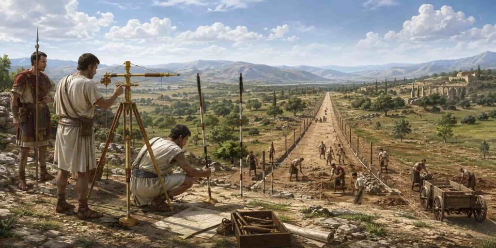
When entirely new roads were required, Roman engineers and surveyors used specialised measuring tools to study the land, choose the most direct route, and guide the construction process. These instruments helped them plan roads with greater accuracy, alignment, and efficiency.
Essential Tools Used by Roman Surveyors
Roman road builders regularly depended on three main surveying instruments: the dioptra, groma, and chorobates. According to Adriana Panaite, a researcher at Romania’s Vasile Pârvan Institute of Archaeology, these tools played an important role in planning and constructing Roman roads.
Each instrument had a specific purpose, helping engineers measure angles, establish straight alignments, and check ground levels. Together, they allowed Roman surveyors to design roads with greater accuracy, stability, and precision.
How Roman Surveying Tools Worked
The Dioptra: Measuring Direction and Angles
The dioptra is known mainly from ancient written records, as no confirmed example has been discovered through archaeological excavation. According to M. J. T. Lewis, a former historian at the University of Hull, its design was not always the same.
In his book Surveying Instruments of Greece and Rome, Lewis explained that the device usually included a supporting stand, a circular base, and a narrow sighting tube. A Roman surveyor could look through the tube to focus on a distant object while blocking unwanted light. This made it easier to measure direction, observe fixed points, and create accurate road alignments.
Read Also: Hawaii Builds Roads From Fishing Nets [Ocean Rescue]The Chorobates: Checking Ground Levels
The chorobates was mainly used to measure horizontal surfaces and differences in elevation. It was approximately 20 feet, or 6 metres, long and consisted of a wooden beam supported by legs, making it look similar to a narrow table.
Small hanging weights may have helped surveyors check whether the beam was perfectly level. However, no original chorobates has survived, so historians are still uncertain about its exact design and operation. Ancient descriptions suggest that it worked like a modern builder’s level, helping engineers establish level points and measure changes in ground height.
The Groma: Creating Straight Road Lines
The groma was probably the most important instrument used in Roman land surveying. According to Joseph Lewis, an archaeologist at the University of Cambridge, it was the main tool used by the mensor, or Roman land surveyor, to plan long and straight routes.
The instrument helped surveyors establish accurate right angles, fixed sight lines, and direct construction paths. These straight alignments were especially useful when Roman engineers built roads across flat or gently sloping land.
Together, the dioptra, chorobates, and groma allowed Roman engineers to measure angles, check ground levels, and design remarkably straight roads with impressive accuracy and precision.
How the Groma Measured Right Angles
The groma, also known as the gruma or croma, was an important Roman surveying instrument. It had a tall vertical pole with an X-shaped horizontal cross fixed at the top. Four plumb lines, each carrying a small weight, hung from the ends of the crossbars.
Roman land surveyors used the hanging lines to create accurate sight lines and measure right angles. This made the groma especially useful for planning straight roads, marking land boundaries, and setting out organised construction layouts.
How Roman Surveyors Kept Roads on the Correct Route
Roman surveying teams worked together to maintain the correct road direction. Surveyors positioned their poles at different points and used the hanging plumb lines to check whether each marker formed a straight line.
One surveyor usually stood at the starting point and guided the others until their poles were properly aligned. After establishing the main route, the team studied the surrounding landscape and adjusted the road where necessary.
Roman engineers often changed the planned course to avoid steep slopes that could make travel difficult for wheeled vehicles. They also selected suitable places for river crossings and redirected roads towards existing towns, settlements, and important destinations.
Road-Building Methods Across the Roman Empire
Roman roads were not constructed using one fixed method everywhere. The Roman Empire covered a vast geographical area and existed for many centuries, so engineering practices likely differed between regions and historical periods.
Local terrain, available building materials, climate, labour skills, and earlier road systems all influenced how each route was designed and constructed. Therefore, historians should avoid assuming that every Roman road followed exactly the same surveying and construction techniques.
Why Roman Roads Did Not Follow One Pattern
The appearance and quality of Roman roads often depended on the people who built them. Road construction was probably carried out by a mixed workforce that included soldiers, enslaved people, prisoners, and local residents required to provide labour under a system known as corvée service.
According to historian Richard Talbert, communities were sometimes ordered by Roman authorities to supply workers for public building projects. However, trained and paid craftsmen were likely employed for specialised jobs, especially the construction of bridges and other complex structures.
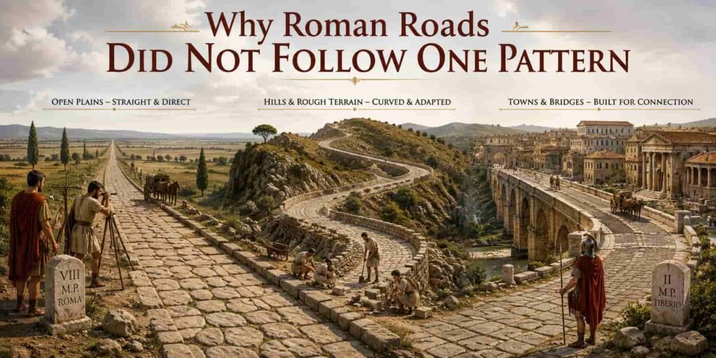
Although Roman roads are widely known for their accurate planning and long, straight sections, this description does not apply to every route. Differences in terrain, local labour, available materials, and engineering needs meant that many roads included curves, slopes, and changes in direction.
How Terrain Shaped Roman Road Design
Roman roads are often described as perfectly straight, but this is only partly accurate. Roman engineers had access to a large labour force, which sometimes allowed them to reshape the surrounding landscape and create direct routes.
According to classical archaeologist Tom Brughmans of Aarhus University, Roman planners likely preferred straighter roads where the topography created few difficulties. In flat and open areas, engineers could follow a more direct alignment with fewer obstacles.
However, roads in mountainous regions and other challenging landscapes often included bends and changes in direction. These adjustments helped builders avoid steep slopes, unstable ground, and difficult natural barriers.
Brughmans also suggests that future archaeological research may show that Roman roads were generally less straight than many modern roads. Modern routes are often designed for fast motor vehicles, which require wider curves and smoother turns for safety. Roman roads, by contrast, were mainly built for walking, animals, carts, and slower forms of transportation.
Read Also: DNA Origami Vaccines May Beat mRNA [Next Leap]Summary: How Did Romans Build Such Straight Roads? [Revealed]
Roman engineers built an extensive road network across Europe, North Africa, and the Middle East to support trade, travel, communication, and military movement.They used tools such as the dioptra, chorobates, and groma to measure angles, check ground levels, and create straight alignments.Surveying teams worked together to mark routes, avoid steep slopes, cross rivers, and connect important settlements.However, not every Roman road was straight because terrain, climate, labour, materials, and local conditions affected construction.Roman roads were usually straighter on flat land, while routes through mountains and difficult landscapes often included bends.